Project Overview
Help shape the future of walking, cycling, and rolling in Prince George!
The City of Prince George is developing an Active Transportation Plan to create a complete and comfortable active transportation network for people of all ages and abilities, making it easier and safer for residents to get around by walking, cycling, rolling. The Active Transportation Plan will help guide decision-making and investments related to active transportation improvements.
The Active Transportation Plan focuses on commuter trips and active transportation routes that are on, or adjacent to, roadways. The network recommendations included in the Plan provide connections to trails and other recreational facilities, but this is not a Trails or Parks Plan and there are no trail rustic or local trail projects proposed as part of the active transportation plan.
What We Heard
First Round of Engagement (July 2025)
In July 2025, the City launched the first round of community engagement for the Active Transportation Plan. This phase focused on raising awareness of the plan, understanding community interests and priorities, and identifying gaps and opportunities within the existing active transportation network. Engagement activities were supported by a review of existing conditions and informed by transportation-related feedback gathered through the Official Community Plan engagement process between September 2023 and October 2024. Transportation emerged as a major theme during the OCP process, and key findings were incorporated to provide additional context for the ATP.
Second Round of Engagement (Fall 2025)
Based on input from the first round of engagement and the review of existing conditions, the project team developed preliminary actions, proposed network maps, and a list of potential infrastructure projects to improve active transportation in Prince George. The second round of engagement sought feedback on these draft materials to help refine and prioritize actions and projects. Community input collected through surveys, which closed on December 14, 2025, helped inform the development of the draft Active Transportation Plan and ensure it reflects community priorities and interests.
-
-
Community Engagement Summary: Round 2 Engagement
-
Existing Conditions Summary and Community Profile
What's next?
Following our second round of public engagement and the Open House in December 2025, our project team has been working closely with City staff to incorporate Round 2 feedback, refine the concept design, and prepare the final Active Transportation Plan. We would like to thank everyone who took the time to participate and share their input. Your feedback has played an important role in shaping the plan.
We expect to present the draft Active Transportation Plan to Council by the end of April, 2026.
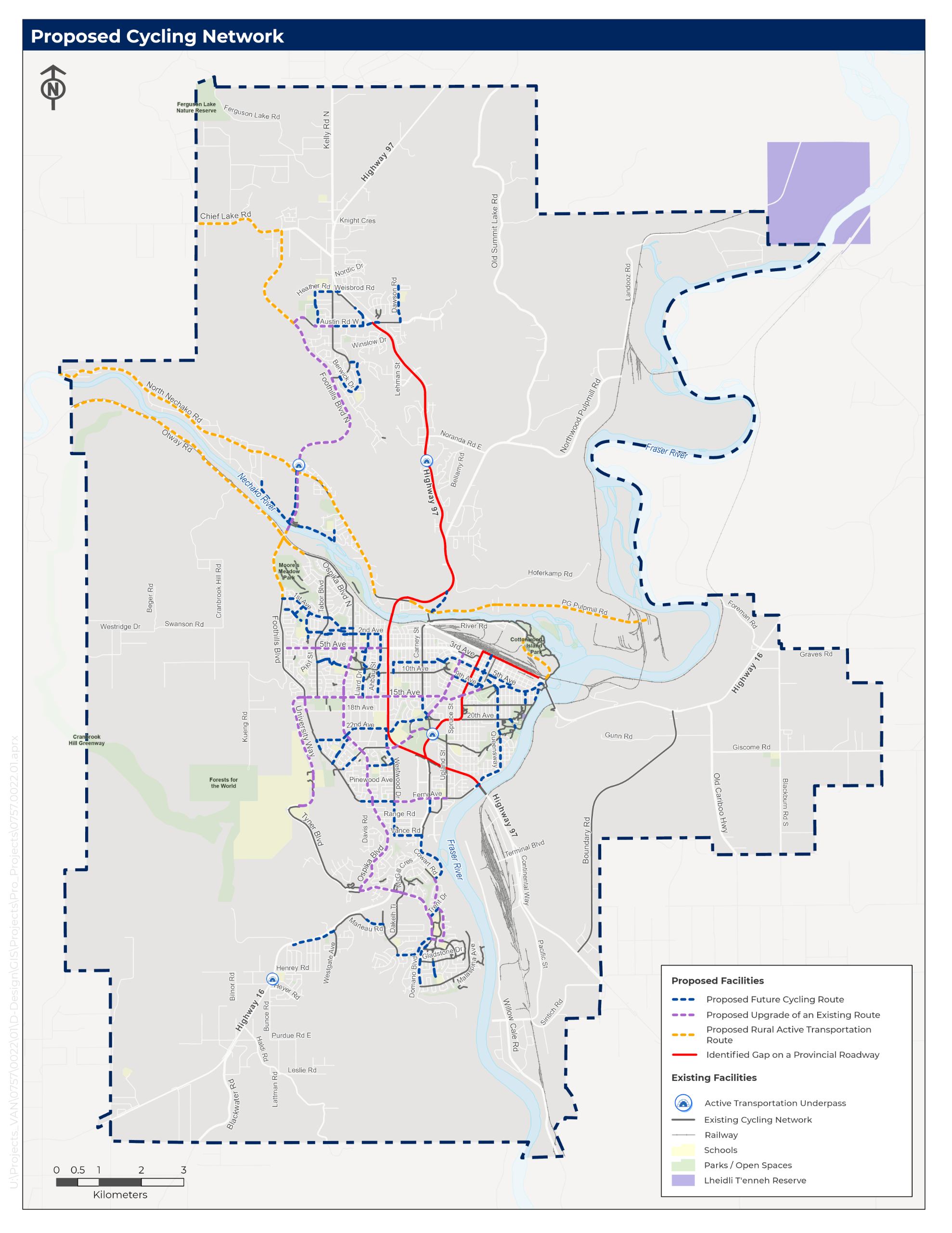
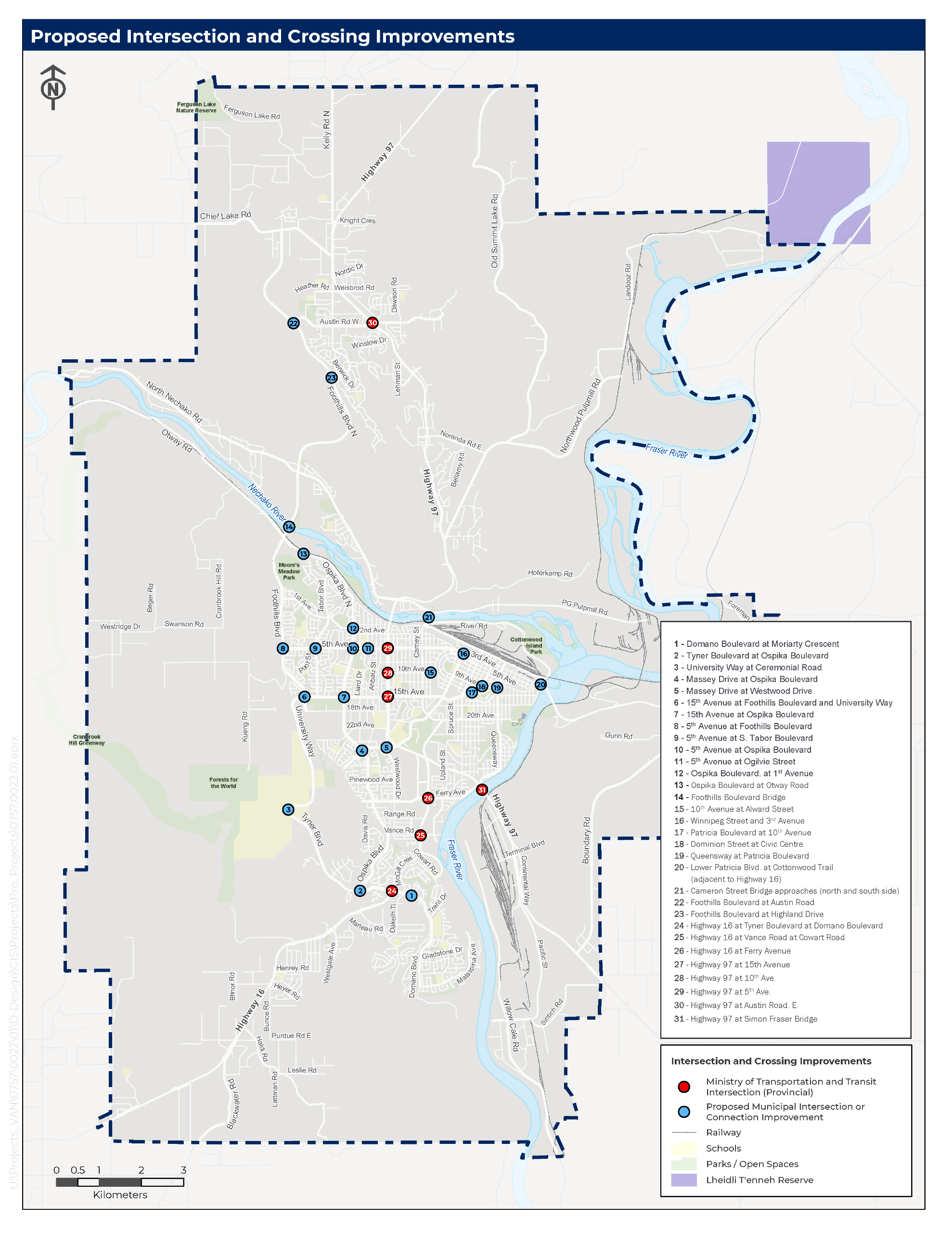
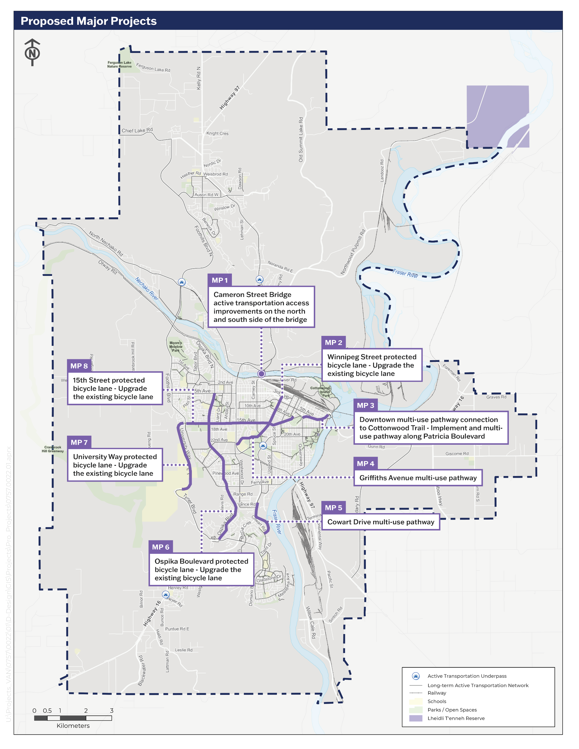
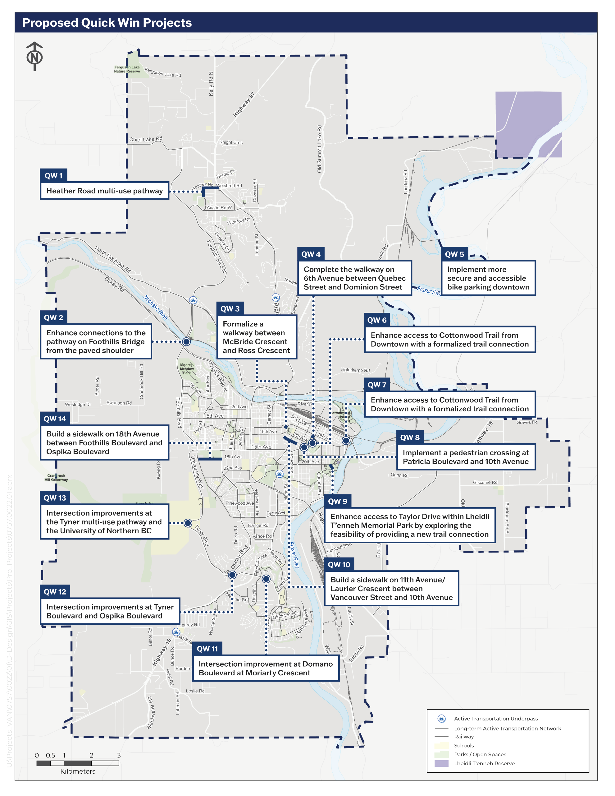
Proposed Network & Infrastructure Improvements Maps
Check out the draft maps: Pedestrian Network Improvements, Cycling Network Improvements, Intersections and Crossings Improvements, "Quick Win" Projects, and Major Projects. Click here for a readable PDF of the engagement materials.
Legend Background:
- The proposed identified Pedestrian Network Projects and Gaps refer to new sidewalks and multi-use pathways that close gaps and improve connectivity for people walking and rolling.
- Proposed Future Cycling Routes refer to new connections - such as multi-use pathways, protected bike lanes, painted lanes, and neighbourhood bikeways - that expand the network and fill gaps.
- Proposed Route Upgrades refer to improvements to existing routes that enhance comfort and safety through added separation from motor vehicles.
- Proposed Rural Active Transportation Routes include short-term measures like signage and pavement markings, with long-term opportunities for paved shoulders or off-street trails.
- Identified Gaps on Provincial Roadways reflect locations where the City will continue advocating to the Province for higher-quality infrastructure.
Please provide your feedback through Community Survey Part 2.